To make your own stamps With the stamp preset tool all you have to do is change the selected alpha in the alpha palette… You don’t have to always use the default! and you won’t lose it, just select any alpha and that’s what it will get stamped… If you notice the alpha will skew with the slope, you can change that in the picker menu…
SplatMaps are just a way game engines (like unity) use to get 4 different alphas from a single image file to distribute materials ( each channel is a different alpha) but you don’t really need them in VUE.
In VUE You can use an alpha (wetmap, slope map, etc) as mask to determine where a VUE material shows or where doesn’t in the terrain, you can use the exported PSD directly from ZBrush so no real need for splatmaps but I am Not sure if you can use them.
The splatmap you can create with terrain tools is a little bit more complex than merely putting 4 alphas together in channels but not much more than that…
Make dynamesh was just a convenient way to quickly convert the terrain into something you can freely sculpt, make caves and overhangs and other terrain features that aren’t possible with just displacement on a plane…
Thanks… very, very cool & helpful. :) small_orange_diamondsmall_orange_diamond
Lots to work on! 
dargelos,
any new developments in Terrain Tools? Hope to upgrade to the next version asap…so many possibilities. 
BTW, not sure if others are already doing this, but there’s a virtually infinite resource for alphas to create stamps for terrains…just look up on a nice cloudy day. 
First, I took this image,
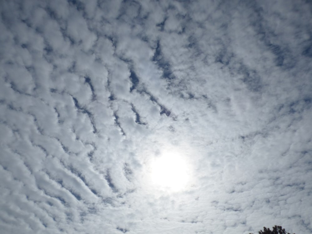
Then, re-sized it to 1024x1024.
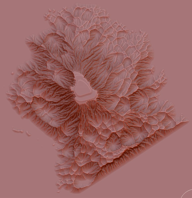
Next, used Shader Map3 to create a displacement map.
Finally, imported into ZBrush as an alpha, and
used Terrain Tools “Sharp” filter to create this terrain (btw, didn’t try Dynamesh, Zremeshing or creating UVs yet; after creating polymesh, OBJ = 52mb)
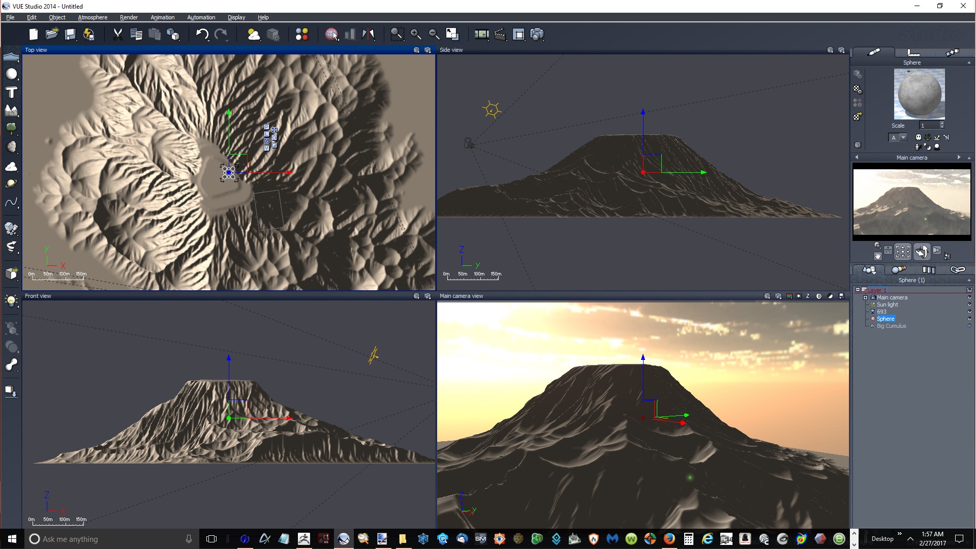
Exported OBJ, and imported into VUE (2km x 2km x 250m)
If anyone wants the source files to use, here they are (~145mb zip) including original jpg, and tif, exr, png, tga, hdr displacement maps. 
Attachments
Hey MegaCal…
WOW, you used the picture of a cloudy sky as an elevation and then applied some filters on it? that’s very cool!!!
I haven’t really worked on this for a while but I keep having ideas (and abandoning them shortly after).
Some things I would like to add are:
-
Create terrains from perlin noise and voronoi. I didn’t do it before because it’s actually pretty easy to get a plane in ZBrush and apply noise to it, you don’t even have to apply it ,displace the geometry or have a highly subdivided plane. it’s enough to let the noise show in your plane, fill the document with the tool and then exit edit mode. So I thought I wouldn’t bother to do it but it’s always better to do things with just one click…
-
Some nice tools to make natural looking paths and roads…
-
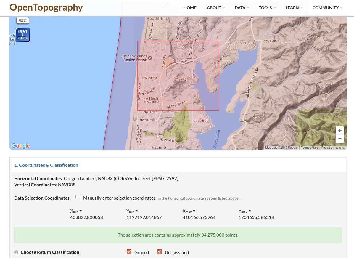
Importer for Arc ASCII Grid file format generated by OpenTopography.org so we have a way to directly import real world elevation data with a lot of detail, many regions are Bare-Earth , so no trees or building ( just the bare terrain data with crazy detail! … I like this format simply because it works and I understand it jaja but file sizes are big.
dargelos wrote:
Hey MegaCal...WOW, you used the picture of a cloudy sky as an elevation and then applied some filters on it? that’s ver my cool!!!
Thanks!  I’ve always been fascinated with clouds. They are so random & varied naturally. No two are alike, so endless possibilities.
These were from a single jpg, but need to try RAW and HDR (3 bracketed jpgs…one “right on” and 2 others, +/- 2ev).
I haven’t really worked on this for a while but I keep having ideas (and abandoning them shortly after).
Some things I would like to add are:
- Create terrains from perlin noise and voronoi. I didn’t do it before because it’s actually pretty easy to get a plane in ZBrush and apply noise to it, you don’t even have to apply it ,displace the geometry or have a highly subdivided plane. it’s enough to let the noise show in your plane, fill the document with the tool and then exit edit mode. So I thought I wouldn’t bother to do it but it’s always better to do things with just one click…
- Some nice tools to make natural looking paths and roads…
- Importer for Arc ASCII Grid file format generated by OpenTopography.org so we have a way to directly import real world elevation data with a lot of detail, many regions are Bare-Earth , so no trees or building ( just the bare terrain data with crazy detail! … I like this format simply because it works and I understand it jaja but file sizes are big.
Sounds great! :)small_orange_diamondsmall_orange_diamond
I would really like to work on it further.
Hi Ignacio, first of all, thank you for your grate plug-in, overall Im new to zBrush and been learning a lot, your plugin was easy and straight forward. I did run into an issue that you might know if it can be done or not…
I imported my lo-res OBJ of my mountain with the exact shape I need it to be, I imported into my scene and view it from the top view, then I went into 2.5 mode and applied your plug-in, It worked great and start applying all the details which it did an excelent job it knew where the peaks of my mountain were. When I decided to press the make it 3d, it gave me back a flat volume in the shape of a rectangle… Is it possible or a work around to be able to use your plug-in to apply more detail to existing 3d geometry?
Thanks for all!
Fabio
It would awesome to use TerrainTools in ZBrush 2018
Awesomeness !!
Thanks for the cool plugin and all your efforts are very well appreciated
FYI, no problems so far using Terrain Tools in ZB2018 (Win64)
I haven’t tried all the bells & whistles yet, but so far, so good. ;)

TT terrain imported to VUE 2016

Attachments
So far the only issue I found in ZB2018 is the adjust height button because the taper deformation isn’t working as it used to…
I find that button pretty lame anyway and I don’t think it should be there at all.
I want to find some time to do an update… I already made a multithreaded version of some of the filters so they can run faster on bigger documents, more drops etc. They are looking good.
Also I think I should simplify the usage of the filters because many of the variables are very obscure and hard to understand. At least I should do a better job explaining them.
I would like to do some kind filter that would work on 3D meshes, not only for terrains but mostly for other stuff like a map for flow of water running over the surface of the 3D model and exported as a vertex mask, as we have cavity and peaks and valleys… I think it would be very good for texturing …but that might even be a different Plugin.
Hey dargelos,
great that you’re updating Terrain Tools, and making controls more intuitive…really cool plugin! ;)small_orange_diamondsmall_orange_diamond
I have updated Terrain Tools. Now the filters are multithreaded and should run a lot faster… they work better on bigger terrains. Also I added an importer to ASCII arc files so you can import real elevation data from sources like opentopography. Let me know if you find some bugs.
Awesome!! ;)
Thanks for the update. I will try it asap, and hope to post something worth seeing later.
Are the original video tutorials still relevant?
Fantastico! Your Terrain Tools are running super fast now. Thank you a bunch for the update Ingnacio.
Wow it’s amazing more faster ! Thank’s Good job !
This is a really awesome tool. Exactly what I was needing for a project I’m working on. Thank you!
I am having an issue I’m hoping you can help me with. Once the terrain is converted to 3D, if the tool is redrawn onto the canvas (ie Loading the tool to continue working on it), the landscape is squished along the Z axis into a long rectangle.
Oddly, under Geometry > Size, it actually shows my original dimensions of X 2.0, Y 0.1, Z 2.0. If I scale Z up to 10, that seems to bring it back to the original size on the canvas, but then it’s wrong when exporting.
Is there any fix for this?
Convert to 3D is nothing more than applying a displacement to a plane. I believe the cause of the issue is Zbrush camera view is distorted for some reason. if the size is (X = 2 , Y = 1 (1 displacement factor) , Z= 2) everything seems to be fine with your model.
what you can do if this problem persists is trying to apply the displacement manually. Divide a plane and go to tool:displacement and select the final result from your alpha menu.
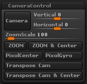
Also you can try to change the camera settings with this plugin to see if that fixes the problem.
http://www.zbrushcentral.com/attachment.php?attachmentid=528220&d=1480540234
Excellent addition, but how to buy it??? I from Russia, don’t accept our cards gumroad, the error of the postal index writes! Where that this addition is even on sale? I want to give you money but I can’t…